Canada's top ten weather stories of 2013
- 2013 - A Year in Review
- 1. Alberta's Flood of Floods
- 2. Toronto's Torrent
- 3. Bumper Crops in the West, So-So for the Rest
- 4. The Nightmare during Christmas
- 5. To Flood or Not to Flood?
- 6. Rebound in the Arctic Ocean and the Great Lakes
- 7. Wicked Winter Weather Wallops the East
- 8. Spring Flooding in Ontario’s Cottage Country
- 9. Prairie Winter Went on Forever
- 10. Stormy Seas and Maritime Tragedy
- Runner-up Stories
- Atlantic Regional Highlights
- Quebec - Regional Highlights
- Ontario - Regional Highlights
- Prairie Provinces - Regional Highlights
- British Columbia - Regional Highlights
- The North - Regional Highlights
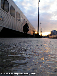
2. Toronto's Torrent

A summery air mass with embedded “garden-variety” thunderstorms tracked across much of southern Ontario during the afternoon and evening hours of July 8. The only thing worrying forecasters was its exceptionally high precipitable water content and slow motion. What had been an uneventful day began to change mid-afternoon when a small cluster of thunderstorms passed over Georgian Bay and continued south-southeastward. By 5:00 p.m. it was raining heavily at the centre of the storm just north of Highway 401 and at Toronto Pearson International Airport. At the same time, another weaker line of thunderstorms formed northwest of the Greater Toronto Area (GTA) and travelled southeastward toward the city’s downtown. By 5:30 pm the relatively weak storm blossomed dramatically. Suddenly, Toronto faced two separate storm cells – one on the heels of the other – that slowed then stalled over the city. The one-two weather punch delivered more rain in two hours than Toronto usually sees during an entire July. Moreover, the storms were targeting the most urbanized area in Canada. Rarely before had such a drenching thunderstorm soaked a surface with more cement than grass. The following rainfall totals (mm) from in and around the GTA help to illustrate the bull’s-eye target of the event on the downtown: Toronto Pearson 126.0; Toronto City 96.8; Toronto Island 85.5; Downsview 65.8; East York 51.5; Richmond Hill 19.8; Oshawa 4.8; Oakville 4.2; and Hamilton 4.2. The storm was noteworthy because of the rain’s intensity, far exceeding storm sewers’ capacity, which caused flooding runoff to travel along city streets to creeks and rivers. The majority f rain fell in two hours from approximately 4:20 p.m. to 6:30 p.m. Many compared the storm’s rainfall to that from Hurricane Hazel in October 1954.
Exacerbating the storm’s impact was the 38 mm of rain that had fallen on the city the day before. Adding to that was an abnormally wet spring and early summer – the dampest since 2000. From April 1 to July 7, Toronto Pearson got between 50 and 75 per cent more rain than normal. And talk about timing. The storm hit during afternoon rush hour leaving millions of vulnerable commuters in transit between work and home. The 126.0 mm was a new daily rainfall record at the airport (station records date from November 1937) and a record for any July date (the previous daily rainfall record for July was set on July 28, 1980 when 118.5 mm of rain fell). The previous daily record for any day at Toronto Pearson was set during Hurricane Hazel when 121.4 mm fell on October 15, 1954. The July 8 storm also set a record for 30-minute and 1, 2, 6 and 12-hour rainfall totals at Toronto Pearson, all in excess of 100-year return periods. Interestingly, the storm’s daily rainfall was NOT the highest recorded value at any Environment Canada archived rain gauge within the GTA. At North York (Downsview), 140.6 mm of rain was recorded on August 19, 2005, with maximum accumulation of 175 mm (unofficial) in a Thornhill backyard. The highest historical daily rainfall outside of Toronto occurred northwest of Pearson Airport at Snelgrove where 181. 6 mm fell during Hurricane Hazel.

The Insurance Bureau of Canada estimated the July 8 storm costs at close to $1 billion in damages – the most expensive natural disaster ever in Toronto and Ontario. The storm caused major transit halts and delays, road closures, flight cancellations and flooding across Toronto and Mississauga. The epic rainfall left several roads and underpasses under water, forcing motorists to abandon their vehicles. Videos captured cars bobbing up and down on streets and highways, sinkholes opening up and snakes swimming inside stalled commuter trains. Thousands were stranded, necessitating rescue by boat in some instances. Others abandoned their vehicles and walked thigh-high in water along roads that looked more like canals. About 500,000 households, mainly in the GTA’s west end, were without power ranging from hours to days. Some 3,000 basements flooded in the rainstorm, causing major damages.
- Date modified: